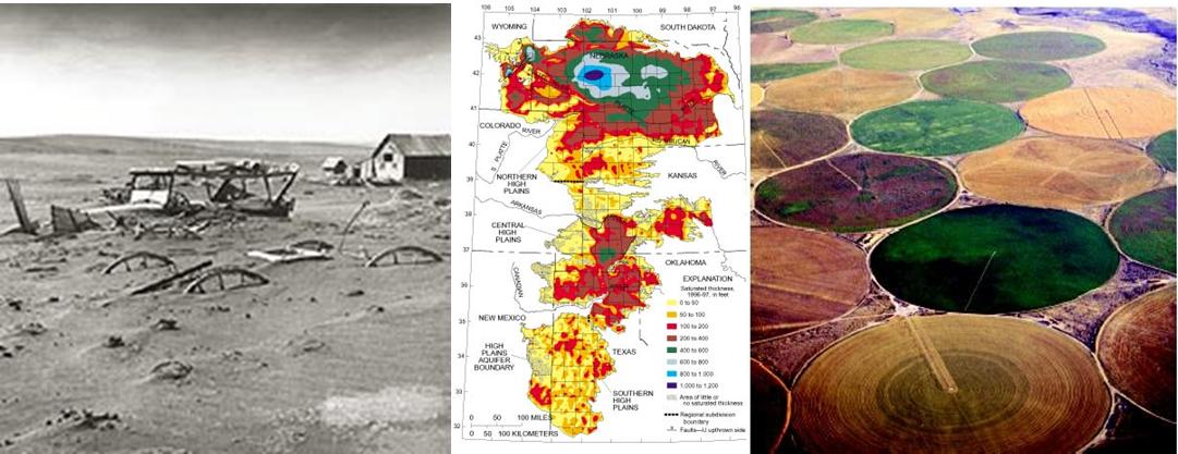
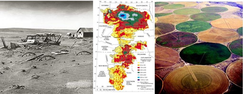
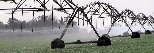
If you are unfamiliar with the Ogallala, this is the aquifer that lies under much of the Central Plains of the United States. In the pictures and map seen below on the left we can see a reminder of the Dust Bowl, in the centre a map showing the current state of the Ogallala in terms of water reserves with red and yellow areas indicating the most depletion, and the image on the right showing irrigated fields that were once Dust Bowl but now because of the draw from the aquifer are productive farmland.
The Ogallala is fossil water and a finite resource. Fossil water is water accumulated over thousands of years. It is not easily restored once used.
On the map above you can see the Oklahoma Panhandle just above and to the left of the legend. The Panhandle Regional Water Plan, the stewards of the water from the aquifer, have instituted conservation and new irrigation strategies to extend the life of the resource. Water use from the Ogallala peaked in the 1970s. It has been dropping ever since and in the years between 1995 and 2005 the Panhandle’s use dropped from over 2.2 billion liters (600 million gallons) to 832 million liters (220 million gallons). During that same period Panhandle farm acreage increased from 93,400 to 94,000 hectares (230,918 to 232,058 acres). Will action like this save the Ogallala? Not without other water jurisdictions practicing similar resolve. Clay Pope is Executive Director of the Oklahoma Association of Conservation Districts. He states:
“The folks who farm and ranch in far Northwest Oklahoma either lived through the Dust Bowl themselves or had grandparents and parents who lived through that horrible time,” Pope said. “It’s telling that during this time of record drought, the land in the Panhandle has actually been in better shape than a lot of the farm ground down state. That’s a real testimony to the lessons these folks learned the hard way about protecting our natural resources.”
Meanwhile scientists and conservationists are predicting that even with reduced drawing of the Ogallala, the aquifer will be almost fully depleted within a few decades. For the Central Plains this may mean a return to Dust Bowl conditions particularly as global warming exerts its own influence on rainfall patterns which right now are predicted to lead to even more prolonged droughts for Central North America.


The Ogallala pops up every once in a while as a looming water crisis, so I’m glad to see someone somewhere is taking it seriously.
By coincidence today, here’s an article by the CEO of Nestle on water use for power generation. One astounding assertion is that power plant cooling accounts for half of water use (somewhere, he was not specific on region).
Somehow agricultural and industrial use have to be rationalized, or conservation in one area will just be eroded by lack of conservation elsewhere.
https://www.linkedin.com/today/post/article/20130417131801-230883806-water-as-the-hidden-power-behind-world-energy?goback=.ptf_*1_*1_*1_*1_following_*1&trk=who_to_follow-b
Correction, the article states that the consumption of water noted above is for the US.
Using freshwater as a coolant for power generating stations seems to me to be an enormous waste of a vital resource. You would think someone would have come up with a gray water coolant system, or developed a technology that could use salt water in coastal areas.