December 9, 2013 – In Part 2 of this posting discussing how climate change may impact Africa’s rivers we look at the areas of the continent that are sub-Saharan. The rivers here, like the Nile are all precipitation fed. In this posting we will look at the present and future of the Congo, Zambezi, Limpopo, and Orange.
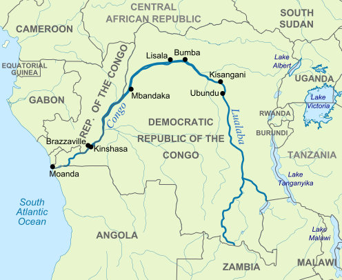
Congo River – This equatorial African river’s watershed covers 4.1 million square kilometers (1.6 million square miles). The river is 4,700 kilometers (approximately 2,940 miles) in length, the distance between Providence, Rhode Island and San Diego, California. That’s a lot of river. In addition the Congo is the deepest river in the world reaching in excess of 230 meters (more than 750 feet).
Like the Amazon River basin the Congo is the atmospheric freshwater engine of Africa and second only to its South American cousin in water volume, discharging more than 42,400 cubic meters (1.5 million cubic feet) per second into the South Atlantic.
The river basin is home to the second largest tropical rainforest which triggers 75 to 95% of the rainfall generated in the region through a massive movement of water vapor.These trees represent a carbon sink 20 to 50 times larger than land put to agricultural use. When we remove them the net result is increased atmospheric CO2. And this is the biggest threat in the Congo River basin today.
As you can imagine the desire of the people inhabiting the Congo River watershed is to improve their lives and deforestation is one of the methods whereby they can capitalize on the resources available to them. But the unintended consequences of this striving for better economic conditions is degradation of the environment. Forest reductions will reduce rainfall much the way they have in Amazonia and Indonesia over the last few decades as both these areas are beginning to see cycles of drought. Forest reductions will certainly change the discharge volume of the river basin. And forest reductions will lead to periodic flooding as denuded areas will no longer retain rainwater during heavy rainfalls.
Today the nations that the river supports are looking to it as a source for hydroelectric power. The river has the potential to power the entire African continent. But building dams will have additional consequences, changing river flow, effecting the fish and wildlife, and causing those inhabiting its banks to change where and how they live.
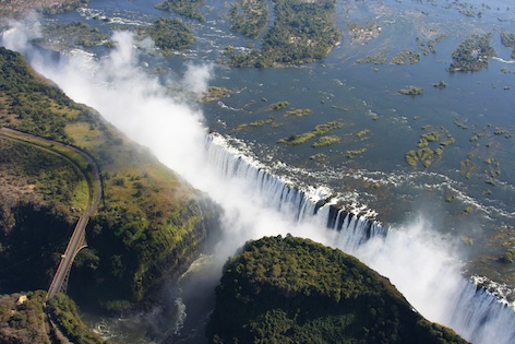
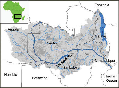
Zambezi River – This is Africa’s fourth longest river and the largest flowing into the Indian Ocean. Extending 2,700 kilometers (over 1,650 miles), equivalent to the driving distance between Las Vegas and St. Louis. This is the river of Victoria Falls (seen below). About half the size of the Nile River basin the Zambezi is home to more than 40 million (expected to increase to 51 million by 2025).
Agriculture is the predominant activity. Unlike the Congo, the Zambezi flows through a varied landscape of wetlands, forests, mines and rapidly growing urban communities. In its upper reaches the basin has experienced massive deforestation. Damming of the river is a further threat to the sustainability of the river volume with up to 40 hydroelectric projects under consideration. Currently 4,684 Megawatts of an estimated 20,000 Megawatts capacity has been developed.
Today because of human activity the river basin is experiencing altered weather patterns with higher incidents of droughts and floods. Deforestation is blamed. Lakes such as Lambezi that form part of the basin have shrunk dramatically because of declines in water volume. Outbreaks of brush and forest fires have increased as well. All of this is leading to increased output of CO2 per capita.
What will rising temperatures from global climate change do? Further exacerbate the problems for the people, domestic animals and wildlife of the region.
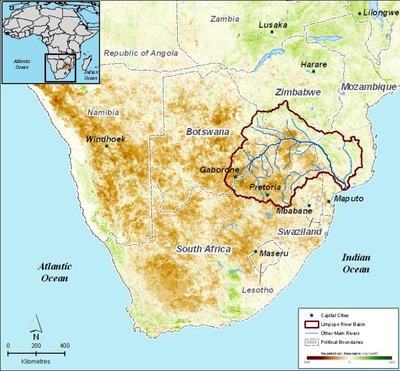
Limpopo River – This southern Africa river is the second longest flowing into the Indian Ocean. Total length is approximately 1,750 kilometers (1,100 miles). Unlike the Congo and Zambezi the Limpopo suffers from unreliable precipitation with parts of it running dry many days of the year. The upper reaches of the river flow through the Kalahari Desert. Further east the river flows through mixed forest land that is lightly populated. Only in its lower reaches does the river have significant flow volume and in this area the basin is heavily populated.
How will climate change impact the Limpopo? Significantly is the answer. Already a heavily water stressed area of Africa, as climate change intensifies the basin is expected to further dry out. With limited water the people and wildlife of the area will find themselves seriously compromised.
In 2000, unseasonal rainfall contributed to massive flooding of the lower Limpopo watershed. This was just the latest in a series that have been recorded over the last 50 years. And these types of occurrences are expected to happen more frequently separated by periods of prolonged drought. For agriculture in the lower Limpopo these climate shocks will leave much of the population vulnerable to disease and malnutrition.
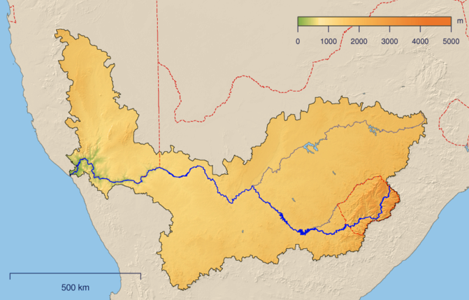
Orange-Senqu River – This is the principal river of South Africa flowing from east to west and emptying into the Atlantic Ocean. It stretches 2,200 kilometers (1,370 miles). The river basin covers 77% of South Africa with portions also in Lesotho, Botswana and Namibia. Of all Africa’s rivers the Orange-Senqu is the only one that experiences winter freezes in its upper reaches. Today 95% of water demand from the river comes from South Africa. But South Africa’s neighbours, particularly Namibia are increasing the amount of land under irrigation, further stressing the river flow.
The climate of South Africa, like that of Australia, is expected to dry out as atmospheric temperatures rise. This will put lots of stress on the water resources of the Orange-Senqu and will impact the current hydroelectric capacity of the river which features a number of power dams. These dams are significantly altering the river flow impacting the lower reaches dramatically.
For South Africa, the country has pretty much maxed out on what it can draw from the Orange-Senqu. The result is an increasing demand for water from subterranean sources. These aquifers are further threatened by plans to build future power dams on the river and its tributaries which will impact the recharge rate of subterranean water sources. The result, a southern Africa increasingly dealing with freshwater scarcity.
Climate change models for the Orange-Senqui predict increased evapotranspiration by as much as 20% and, therefore, increased irrigation requirements. Soils are expected to become drier with reduced crop yields. Fewer but heavier rainfall events will further compromise the populations relying on the river with incidence of drought interspersed by flooding events.
Some conclusions:
As you can see Africa like Australia is most vulnerable to atmospheric warming induced by rising levels of CO2. And sub-Saharan Africa is particularly vulnerable. The sources of rising carbon are not just those coming from the burning of fossil fuels, but also the burning and deforestation of Africa’s rainforests.
When we conclude our look at Africa’s rivers and watersheds in the light of climate change in Part 3 of this study we will zero in on West Africa where Africa’s most populous nation, Nigeria is located. Nigeria and the Niger River are inextricably linked. Other river basins to be discussed include the Volta and Senegal.
