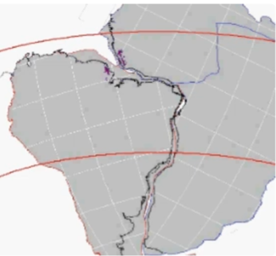
When I was first contemplating my post-secondary academic pursuits, I wanted to study geophysics focusing on plate tectonics. I was inspired by the research and writings of John Tuzo Wilson, who in 1965 had written and published an article in the British journal, Nature on this subject. Wilson was inspired by a German meteorologist, Alfred Wegener, and his theory of Continental Drift. Wegener noted that in looking at the continental coastlines of South America and Africa, they fit together like pieces in a jigsaw puzzle (see the picture at the beginning of this article).
I was head of my school’s Geography Club in 1966 and wrote to Professor Wilson asking him if he could come and speak about Continental Drift to my high school. He agreed and, at the time, it was the thrill of my life to meet him in person. The Geography Club event packed our auditorium with both students and faculty. I never knew how many of my classmates and teachers were as enamoured by this subject as was I.
Wegener’s theory was first proposed to the German Geological Society in 1912. He saw the similarities in the South American and African coastlines. He also saw that the American Eastern Seaboard bore similarities to Africa’s Northwestern coast. The island of Madagascar seemed to fit the coastline of Mozambique. These couldn’t be just coincidences. The reaction from his fellow scientists was less than receptive.
A half-century later, Wilson’s research convinced scientists that Wegener’s observations could be backed by physical evidence and introduced a new term, Plate Tectonics, to explain the phenomenon. Wilson noted that previously unknown fault lines in the Mid-Atlantic and Mid-Pacific Oceans could be causing the continents to drift. He noted that the entire Hawaiian Island chain was moving on an oceanic plate that was drifting from the northwest to the southeast. The most westerly islands in the chain had extinct volcanoes. The most easterly were active. That suggested the oceanic plate was moving over a hot spot in the Earth’s Mantle, the viscous liquid layer lying below the Earth’s crust. Wilson also noted that the faults discovered near the Mid-Atlantic and Mid-Pacific Ridges, a planetwide subterranean mountain range, were not isolated but rather formed a continuous belt circling the Earth. He called these geophysical features, transform faults, and demonstrated how they worked. Earth-monitoring satellites soon proved his observations of continental plate movement to be correct.
The discovery and behaviour of transform faults explained how the continental and ocean plates moved about. But what was causing sections of seemingly stable areas of continents, called cratons, to be thrust upward thousands of metres forming cliffs and plateaus far away from these mid-ocean ridges and transform faults?
Could convection forces within the Mantle provide an explanation? Could these currents affect the mid-section of the continental plates, the cratons? Previously, cratons were thought to be stable and immutable areas of continental plates. A team of researchers from the University of Southampton, University of Potsdam, and Universita degli Studi di Firenze set out to prove that the Mantle was providing the mechanism for uplifts and the formation of mountain chains far from the ocean ridges, faults, and continental edges. They published their findings this month in an article in the journal, Nature.
Up until now, the dynamic of change to cratons was little understood. This newly published research sheds light on how cratons experience isostasy, a rise similar to isostatic rebound, described previously in articles on this site, the observed continental phenomenon that causes post-Pliestocene formerly glaciated parts of land masses to rise. Isostasy comes from below not above. It uplifts the Earth’s crust from action within the Mantle described as waves that migrate along the base or roots of continental plates. Isostasy affects the continental margins and the interior cratons. The margins move while the cratons get swept upward. These uplifted areas of the continental plates are subsequently eroded by atmospheric forces that leave plateaus and escarpments hundreds to thousands of kilometres away from the continental edges.
The physical evidence can be seen in the upswept landscapes of Southern Africa and the East African Rift Valley. The Valley cliffs and plateaus, the researchers hypothesize, formed from an ongoing deep mantle wave travelling under the African continental plate at a rate of 15 to 20 kilometres (9.3 to 12.4 miles) per million years.
No speed limits are broken with mantle wave convection, but the action below the continental root causes erosion of the crust which lightens it causing it to rise to form the geomorphological features seen in East and South Africa today. Mantle waves can last tens of millions of years and, in destabilizing the continent’s cratons, can also impact Earth’s climate. The current Mantle waves have been ongoing since the beginning of the breakup of the supercontinent, Pangaea, which started 195 million years ago and has led to where the continental plates reside today.


