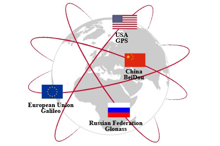
April 2, 2018 – GLONASS, the Russian global navigation system includes 27 satellites providing navigational support to the country’s defense forces. Deployed in 1993 it was the second global positioning system (GPS) to be put into Earth orbit after the United States launched its operation in 1978 with 31 satellites to support its own military needs. In 1994 the American GPS was extended to commercial and civilian use.
Since then the European Union (EU) and China have both launched their own GPS networks. The former goes by the name Galileo and currently has 22 satellites in orbit with plans for 30 in total. The latter, BeiDou, which came into operation in 2000, has 22 operational satellites with plans to complete the network by adding 13 more by the year 2020.
And not to be left out, both Japan and India are developing regional GPS navigation satellites. Japan’s system, called the Quasi-Zenith Satellite System (QZSS) will have 7 satellites when fully operation by year-end. Currently, there are 4 satellites already in orbit. India’s Regional Navigation Satellite System (IRNSS) with 7 satellites is designed to cover the subcontinent and a region up to 1,500 kilometers around it.
The latest Russia-Chinese initiative appears to be a merger according to Izvestia with GLONASS and BeiDou becoming one system capable of sharing navigational data. It is hoped that in combining their GPS it will improve accuracy for both systems. Talks are scheduled for May of this year to complete planning for the new combined system. It will be interesting to see if the combined GPS will offer civilians and commercial operators the equivalent convenience that the American GPS network does today.
GPS has been revolutionary since the first satellites were deployed. The technology has become ubiquitous as GPS receivers have seen their form factor shrink to a point where they can be incorporated into almost any device from mobile phones, to farm machinery, laptop computers, airplanes, all kinds of transit vehicles, cars and trucks.
The U.S. military-grade version is accurate within a few centimeters. The civilian and commercial version is less precise but certainly more than acceptable. When my family drove to Cleveland last summer, and Atlanta, in the fall, the GPS in our Toyota Rav4 served us well. As I write this posting, my mobile phone is sitting beside me here on the desk and when I check location is pinpoints my whereabouts on Google Maps to be across the street from where I am, a deviation no more than 10 meters. That may not be good enough for engineering measurements, but for general navigation purposes, it appears to be more than sufficient.
So how did GPS come about? The idea was first conceived by a researcher who was an MIT graduate working at Raytheon Corporation. As early as 1951 the company proposed to the U.S. Defense Department, a three-dimensional, time-difference-of-arrival position-finding system. With the launch of Sputnik by the Soviet Union in 1957, the technology was finally in place to turn the Raytheon proposal into a reality.
And now we have six different technologies deployed and next-generation refinements coming out that will make these systems more robust, more pinpoint accurate, and cyber secure.


