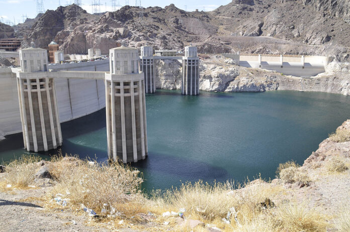
About 15 years ago I attended a technology convention in Las Vegas, Nevada. During a gap in my appointment schedule, I took a day away from the convention floor to drive through the Nevada desert and explore the area around Lake Mead, a reservoir created by the Hoover Dam. At the time of my visit, water levels were visibly below maximum levels with exposed dry land that looked like a lot like a giant bathtub ring. Even then, the lake was experiencing the early stages of a drought that had begun around the year 2000.
There are a number of non-climate change explanations for falling water levels on Lake Mead. It’s a freshwater reservoir for the city of Las Vegas, Los Angeles, and Phoenix which means a lot of water gets piped to these urban centres. Then there is the Upper Colorado River which provides water to many other communities along its route as well as to the farms and ranches that draw upon it. And finally, there is another dam, the Glen Canyon built to generate electricity and forming Lake Powell further reducing the amount of water that finally gets to Lake Mead.
None of these aforementioned reasons for the lake’s falling water levels can be ascribed to climate change. But in all descriptions of the Colorado River and Lake Mead, the words drought and megadrought appear.
Back in 2019, I wrote about the Colorado River, that it was at a tipping point according to the United States Bureau of Land Reclamation. The Bureau described changes happening as beyond megadrought, calling it “aridification.” This is a word that appears in the Fourth National Climate Assessment put out by the U.S. government, a report that was suppressed by the Donald Trump administration.
What is aridification? It is a long-term change process rather than one that is seasonal, where a region becomes increasingly dry based on the measure of soil moisture content. The most observable change besides less precipitation overall are the shrinking of mountain snowpacks both in volume and altitude.
Cycles of drought have been common throughout the geological history of this U.S. region. It is believed that a prolonged drought in the U.S. southwest was responsible for the abandonment of the Anasazi cliff dwellings. The drought started around 1275 and persisted for more than two decades. This wasn’t global climate change but rather a cyclical drought that led to the disappearance of these cliff dwellers.
But today’s drought is linked to global climate change by climatologists. It’s no coincidence that this area which has always been hotter and drier than any other region of the U.S. should be the first to show demonstrable anthropogenic climate change impacts. According to the National Climate Assessment, global warming is expected to stress the region causing biodiversity decline, increasing wildfires and tree deaths, significant risks to existing agriculture, deoxygenation of lakes and rivers, and billions of dollars annually in economic losses that will only increase over time.
The climate models described in the Assessment project a 4.8 Celsius (8.6 Fahrenheit) rise in regional average temperatures by 2100 with the southern part of the region seeing 45 or more days of maximum temperatures exceeding 32 Celsius (90 Fahrenheit). The hotter temperatures are expected to feed the persistent drought conditions, affecting snowpack accumulations in mountainous areas which by 2050 will likely see rain rather than the white stuff except for a few months each year.
Yesterday’s Lake Mead report according to USA Today said water levels were at a new all-time low (36% of capacity and a fall of 42.4 metres (120 feet) since 2000, and 6 of those metres (20 feet) in the last year). At the same time, a Weather Channel report noted that 89% of the Western U.S. was experiencing drought, with 55% of the region in extreme drought.
Coincidence, no. Cause and correlation, absolutely.


