This winter here in Southern Ontario has been the warmest I can ever recall. Lake Ontario has remained ice-free. Even Bronte Creek harbour which we overlook has seldom seen ice form. We are advised that the combination of anthropogenic climate change and a strong El Niño are the reasons for this unusual seasonal narrative.
Climate predictability is an important aspect of planning for farmers. It is equally important for cities and towns. In Canada, the Canadian Centre for Climate Modelling and Analysis (CCCma) simulates Canada’s future climate from seasonal to hundred-year forecasts. CCCma has six models simulating global, regional, ocean and atmospheric changes. The ability to drill down to localities is not currently available. The last update on the government site bears a June 6, 2017 date stamp. A lot has happened to the world’s climate since these simulations were constructed. If I am a city manager looking for mitigation and adaptation strategies in the future, Canada’s federal effort to date needs work.
The United States, on the other hand, has developed a far more robust climate simulation capacity. The Center for Climate Resilience and Decision Science (CCRDS) is located at The Argonne National Laboratory in Illinois. It has launched a Climate Risk and Resilience Portal (ClimRR) for individuals, governments and organizations to study simulated future climate conditions from mid-century to 2100.
CCRDS is using a supercomputer to manage and model the data. Local communities can examine current, mid-century and end-of-century climate data points and download Local Climate Projections Reports. The National Map Explorers tool provides historical baseline, mid-century and end-of-century heat indices, temperature maximum and minimums, degree days, fire weather indices, precipitation, drought and wind-speed projection maps for the entire country with the ability to drill down to specific towns, cities, counties and states. Data reports can be generated in CSV formats to populate spreadsheets and databases.
The portal offers sample cases to help users how to create similar ones for their localities. These use cases can allow public health officials and emergency response managers to prepare for extreme climate changes and update mitigation and adaptation plans. Communities with limited resources can use the climate vulnerability data to help apply for federal, state and philanthropic funding to build local resilience.
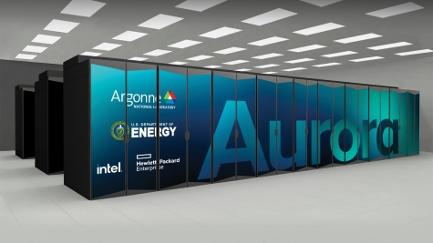
The supercomputer that hosts ClimRR is currently the second fastest in the world. Called Aurora (see picture above), it will soon be upgraded to become the fastest. Aurora is being used to train artificial intelligence weather models to help with extremely local forecasting. The granularity that ClimRR can produce using Aurora’s supercomputer horsepower will allow for neighbourhood-specific weather forecasts that predict precipitation leading to flooding, or thunderstorms spawning tornadoes. Aurora’s ability to do 2 billion-billion calculations per second will make it Earth’s most powerful climate change prediction tool.


