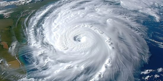
What is a disaster intensification loop? It is a process where one event exacerbates the next one and so on. When it comes to climate change, Hurricane Helene and now Milton represent a good example. We are seeing many more when we look at how weather patterns are changing.
Here in Southern Ontario, rainstorms and wind events are more intense. Our summers are hotter. In winter we get polar vortices that cause precipitous temperature drops that can linger for weeks and then suddenly vanish. The world’s weather systems here and elsewhere appear to be increasingly out of whack.
Climate scientists tell us that no individual hurricane, tornado, thunderstorm or heatwave is proof of global warming, but disaster intensification over multiple events and years confirms the predicted consequences of a buildup of greenhouse gasses in the atmosphere.
We have witnessed the greatest loop intensification threat this week after Hurricane Helene wreaked havoc from the Florida coast to North Carolina’s Blue Ridge Mountains. Following it comes Hurricane Milton, which will have made landfall near Florida’s Tampa Bay by the end of today.
Helene sideswiped the Tampa Bay area and now just days after with above average Gulf of Mexico surface temperatures feeding Milton making it even more intense. Over 24 hours Milton saw maximum sustained wind speeds increase 56 kilometres (35 miles) per hour. As the hurricane approaches the shallows of Tampa Bay, Gulf water will pile up against the shoreline causing an enormous storm surge estimated to reach a height of 3 to 4.5 metres (10 to 15 feet). With fallen trees, and destroyed home debris from Helene’s near miss still being cleared as I write this.
With Milton’s winds expected in the Tampa Bay area by 2 p.m. today, the risk of flash flooding from the storm surge and precipitation across central Florida from the Gulf Coast to the Atlantic is high. The coastal cities of Tampa, Dunedin, Clearwater, Tarpon Springs, St. Petersburg, the Pinellas Peninsula, Sarasota, Bradenton and as far south as Port Charlotte will experience the storm surge and rain. The worst impact will be the Pinellas beach communities and the bay behind it. Inland, Orlando and other communities in central Florida will see the hurricane spawn tornadoes and produce rainfall amounts of between 15 and 45 centimetres (6 to 18 inches).
In recent studies of North Atlantic Ocean storms since 1990, 88% have experienced the kind of rapid intensification over 24 hours that we have seen with Helene and Milton.
Since 1990 the number of Category 3, 4 and 5 hurricanes has grown with research scientists pointing to higher atmospheric and higher ocean surface temperatures. It is the warmer ocean temperatures that make superstorms like Helene and Milton happen.
Similar phenomena have been seen in storms not originating in the North Atlantic. We are seeing more intense hurricanes off North America’s Pacific Ocean coast. Recent typhoons (the Western Pacific Ocean name for hurricanes) like Typhoon Krathon have exhibited rapid intensification. Kraton made landfall in Taiwan last week and then crossed over to mainland China. In September, Typhoon Yagi made landfall in Vietnam’s coastal provinces of Quang Ninh and Haiphong causing significant damage from winds, rain and storm surge.
Hurricanes arise when ocean surface temperatures exceed 27 Celsius (80 Fahrenheit) extending to a depth of 45 metres (150 feet). The total heat of the upper ocean is tapped into by low-pressure cells that form west of the African coast and then begin to travel east gaining angular momentum with constant fuelling from the water column beneath. Since spring of 2023, global ocean mean surface temperatures have been hotter than any previous period on record. June 2024 marked the 15th consecutive month of record surface ocean sea temperatures. The warmer ocean is making these storms 400 times more likely.
Since 1980, hurricanes and other tropical storms have cost the U.S., $1.4 trillion in damages. Of those storms responsible for at least $1 billion in damages, 70% underwent rapid intensification. The frequency of multiple rapid intensification hurricanes has been increasing at a rate of 1.2 per decade since 1980. Multiple rapid intensification hurricanes between 2000 and 2020 increased 82.43% when compared to the period from 1981 to 2000.
In superstorms like Milton, they experience episodes of strong wind shear causing convective bursts away from the eye of the hurricane. The storm grows larger as a result within a very short period.
For many years, meteorologists thought wind shear inhibited hurricane intensification, but with better data collection they are discovering that some moderate shear (5 to 10 metres per second or 9 to 16 feet) contributes to rapid intensification loops. Hurricane Milton has indeed been in sprint mode since it formed in the western Caribbean and it has exhibited moderate wind shear.


